IntroductionThe Svalex course covers a broad range of geophysics and geology topics. It's arranged on Svalbard, with lectures on the UNIS campus in Longyearbyen and field trips using vessels "Nordstjernen" and "G.O. Sars". E-learning is also used - see learning modules at EAGE "learningGEOSCIENCE" journal web site. More information on Svalex on the project web page www.svalex.net. Participating departments on Norwegian universities are
This web page provides documentation on the RV "G.O. Sars" seismic survey. Click to see photo gallery:
Content
1. Navigation data, field logs, geophysical datasets
Table 1: Data, log files |
||||||||||||||||||||||||||||||||||||||||||||||||||||||||||||||||||


| Date | Gravity station | Ship |
||||||
|---|---|---|---|---|---|---|---|---|
| Time | Location | Values | Remarks | Time | Location | Values | Remarks | |
| 22. aug. 2004 | 15:03 Local time (UTC+2h) |
Longyearbyen Airport | 6401.91 6401.95 6401.93 |
Descriptions: ../gravitymeter/gravity-stations/Longyearbyen-1978.jpg ../gravitymeter/gravity-stations/Longyearbyen-1978-b.jpg |
15:30 Local time (UTC+2h) |
Kullkaien | 6404.30 6404.32 6404.34 |
Distance from quay to sea: 3.0 m |
| 14. sep. 2004 | 10:07 Local time (UTC+2h) |
Dampskipskaia (=Hurtigrutekaia) 3rd mooring point from north. Land gravitymeter put on top of mooring point, which is 41 cm above quay. Made in the mistaken belief that this location was a gravity station. |
5999.16 5999.19 5999.20 |
Distance from quay to sea: 3.0 m Pictures from quay |
10:27 Local time (UTC+2h) |
Dampskipskaia, alongside ship. Land gravitymeter on quay. |
5999.30 5999.31 5999.29 |
Distance from quay to sea: 3.0 m Pictures from quay Ultrasys: Spring tension OFF
|
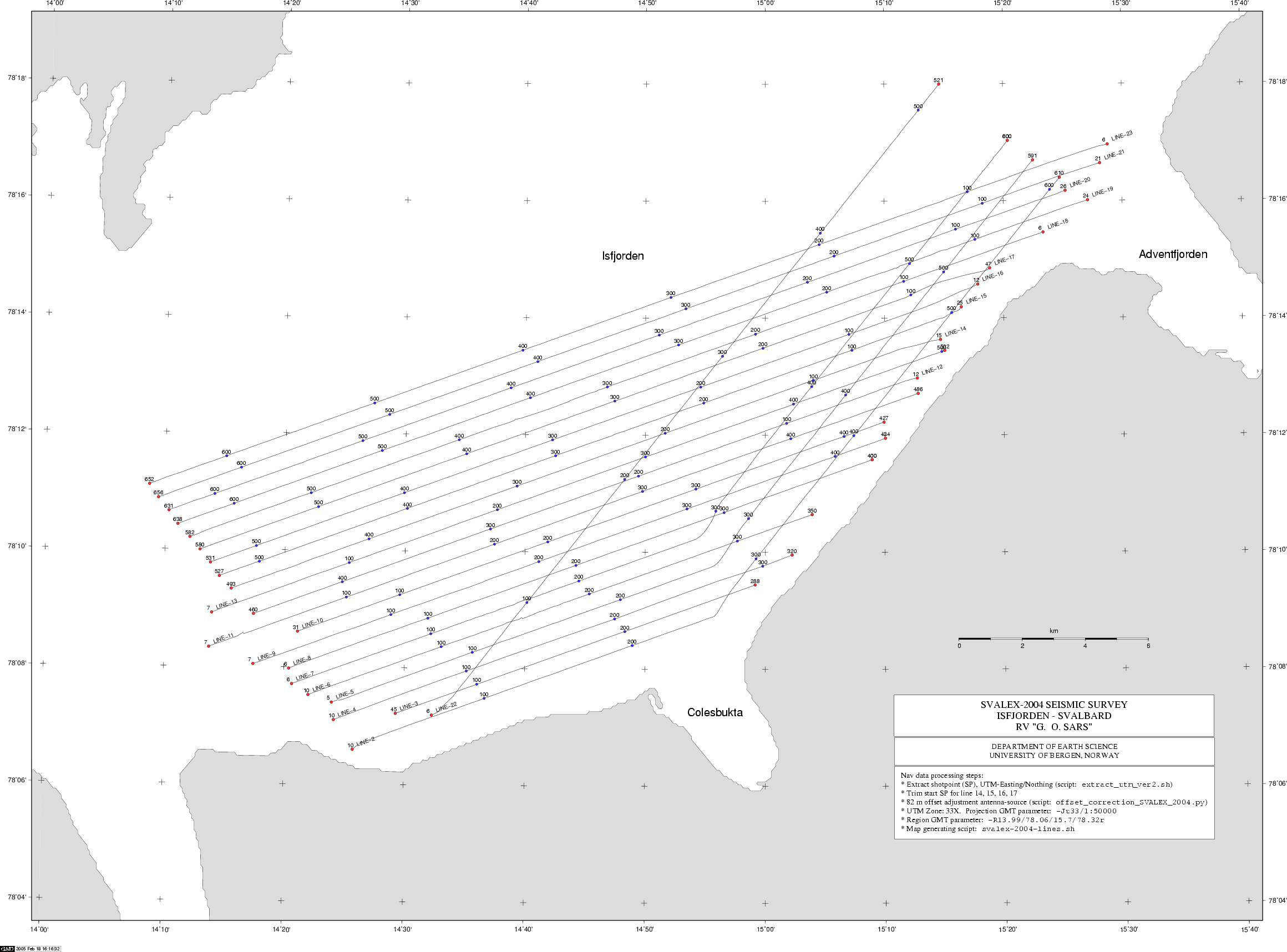
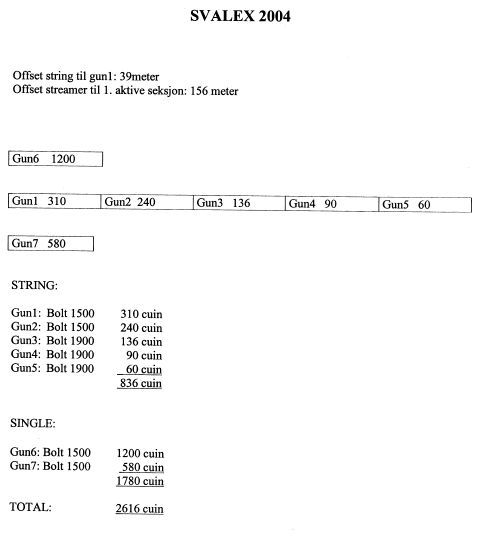
3. Airgun array configuration
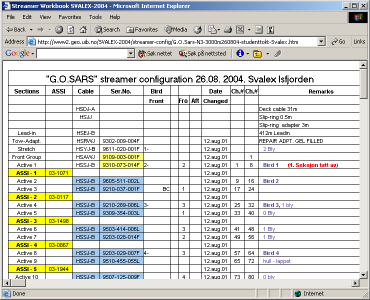
5. Marine seismic streamer configuration
Click to view streamer configuration as of 26. sep. 2004: