GRAVITYMETER
⚠ (:toc:)
<:vspace>
!INTRODUCTION
----
<:vspace>
We are using LaCoste & Romberg gravitymeter, updated with ZLS electronics and software.
<:vspace>
Attach:gravitymeter.jpg"LaCoste & Romberg gravitymeter, updated with ZLS electronics and software."<br />''LaCoste & Romberg gravitymeter with ZLS electronics unit.''
<:vspace>
* [[http://www.zls.com | ZLS Inc. (meaning "Zero Length Spring")]]
* [[http://www.scintrexltd.com/gravity.html | Scintrex, a division of LRS]]
* [[http://www.microglacoste.com/ | Microg LaCoste, a division of LRS]]
<:vspace>
For base readings we use the LaCoste % Romberg land gravity meter G-936:
<:vspace>
Attach:land-gravitymeter.jpg"Land gravity meter"
''Land gravity meter''
<:vspace>
<:vspace>
Our land gravity meter has the following calibration table:
<:vspace>
[[Attach:calibration-table-G-936-1000px.jpg | Attach:calibration-table-G-936-th.jpg]]
<:vspace>
<:vspace>
!BASE READINGS - START OF SURVEY
----
<:vspace>
!!Vessel location Nykirkekaien, Bergen
Attach:base10.jpg"Vessel location 24. May 2009: Nykirkekaien, Bergen."<br />''Vessel location 24. May 2009: Nykirkekaien, Bergen.''
<:vspace>
Attach:base11.jpg"Vessel location 24. May 2009: Nykirkekaien, Bergen."<br />''Vessel location 24. May 2009: Nykirkekaien, Bergen.''
<:vspace>
<:vspace>
<:vspace>
!!Gravity reference station, Realfagbygget Allegaten 41, Bergen
Attach:_slide_NORWAY_Bergen-UiB-a.jpg"Gravity reference station, Realfagbygget, Bergen."<br />''Gravity reference station, Realfagbygget, Bergen.''
<:vspace>
<:vspace>
!!Readings
24. May 2009 - Start of Survey
<:vspace>
%box1%Still readings from gravity meter will be included later.
<:vspace>
%box%<pre class='escaped'>
Realfagbygget:
14:33 UTC : 5408.597
14:36 UTC : 5408.594
14:38 UTC : 5408.597
Nykirkekaien:
Height sea surface - pier: 2.10 m
18:55 UTC : 5413.305
19:00 UTC : 5413.300
19:04 UTC : 5413.299
Realfagbygget:
19:21 UTC : 5408.600
19:23 UTC : 5408.593
19:30 UTC : 5408.590
Nykirkekaien:
Height sea surface - pier: 1.93 m
19:45 UTC : 5413.305
19:47 UTC : 5413.340
19:49 UTC : 5413.330
</pre>
<:vspace>
<:vspace>
!BASE READING - END OF SURVEY
----
<:vspace>
8. June 2009 - End of Survey
<:vspace>
!!Ship location
Ship location: Sterkoder UMOE Yard, Kr. Sund.
<:vspace>
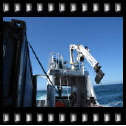
Attach:sterkodern.jpg"Vessel position at Sterkoder UMOE, Kr. Sund"<br />''Vessel position at Sterkoder UMOE, Kr. Sund''
<:vspace>
Attach:sterkodern2.jpg"Detail - vessel position at Sterkoder UMOE yard, Kr. Sund."<br />''Detail - vessel position at Sterkoder UMOE yard, Kr. Sund.''
<:vspace>
Attach:base20.jpg"Sterkoder, Kr. Sund"<br />''Sterkorder, Kr. Sund''
<:vspace>
Attach:base21.jpg"Sterkoder, Kr. Sund"<br />''Sterkorder, Kr. Sund''
<:vspace>
Attach:base22.jpg"Sterkoder, Kr. Sund"<br />''Sterkorder, Kr. Sund''
<:vspace>
<:vspace>
<:vspace>
!!Reference point Kr.Sund
Attach:_slide_NORWAY_Kristiansund-raadhus.jpg"Reference point Kr. Sund"<br />''Reference point Kr. Sund''
<:vspace>
The gravity value is omitted from this gravity point description. We must then refer to this list:
Attach:krsund-point.jpg<br />''Partial list of gravity reference stations - use value from column labelled "IGSN71"''
<:vspace>
%box1%Using value in column labelled "IGSN71", the gravity value in reference station '''Kristiansund P''' is '''9.82177948 m/s^2'''.
<:vspace>
Attach:base30.jpg<br />''Gravity reference point in Kristiansund.''
<:vspace>
<:vspace>
Attach:base31.jpg<br />''Gravity reference point in Kristiansund.''
<:vspace>
<:vspace>
<:vspace>
<:vspace>
<:vspace>
<:vspace>
!!Readings
%box%<pre class='escaped'>
Kr.Sund, UMOE Sterkoder, 2nd bollard from North.
Still reading S-38:
159:07:03:00 9394.8 9395.1 .0 -11.0 -0.6
Height sea surface - pier: 2.55 m
07:28 UTC : 5650.499
07:30 UTC : 5650.500
07:32 UTC : 5650.499
Kr. Sund, Rĺdhuset
07:56 UTC : 5649.082
07:57 UTC : 5649.088
07:58 UTC : 5649.086
Kr.Sund, UMOE Sterkoder, 2nd bollard from North.
Height sea surface - pier: 2.11 m
08:16 UTC : 5650.497
08:22 UTC : 5650.499
08:25 UTC : 5650.491
Still reading S-38:
159:08:31:00 9394.6 9394.3 .0 6.0 0.4
</pre>
<:vspace>
<:vspace>
<:vspace>
!PACKING NOTES S-38
----
<:vspace>
We are using S-38 from Danish Space Agency.
<:vspace>
Here are some prictures of the special packing method required:
<:vspace>
Attach:g1.jpg
<:vspace>
Attach:g2.jpg
<:vspace>
Attach:g3.jpg
<:vspace>
Attach:g4.jpg
<:vspace>
Attach:g5.jpg
<:vspace>
Attach:g6.jpg
<:vspace>
Attach:g7.jpg
<:vspace>
Attach:g8.jpg
<:vspace>
Attach:g9.jpg
<:vspace>
Attach:g10.jpg
<:vspace>
Attach:g11.jpg
<:vspace>
Attach:g12.jpg