NAV DATA FILES
⚠ (:toc:)
<:vspace>
Attach:SP_map_OBS-2009_TopoScandiaDeep_D21A4A.png"Profile 1, 2 & 3: Preliminary shotpoint map"<br />''Profile 1, 2 & 3: Preliminary shotpoint map.''
<:vspace>
<:vspace>
<:vspace>
!UTM ZONE, POSITIONAL REFERENCE
----
All UTM data are relative to UTM Zone 32.
<:vspace>
All coordinates are also relative to the position of the gravitymeter onboard the ship.
<:vspace>
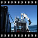
Attach:gravitymeter-position.jpg"Position of gravitymeter in ship"<br />''Gravitymeter is placed at frame 38.''
<:vspace>
Frame distance is 0.6 m.
<:vspace>
%box1%Thus, gravitymeter is 38 x 0.6 = 22.8 m from the stern.
<:vspace>
<:vspace>
<:vspace>
[[<<]][[<<]]
!AIRGUN OFFSET
----
Airguns are positioned 60 meter behind the stern.
<:vspace>
We have to add offset between gravitymeter and stern, to obtain the total offset between source and positions given in navdata files.
<:vspace>
%box1%Thus, total offset between source and positions given in nav data files is: 60 m + 22.8 m = 82.8 m.
<:vspace>
[[<<]][[<<]]
!UKOOA P1/90 FORMAT
----
<:vspace>
Output from nav data processing should be in UKOOA P1/90 format, slightly modified to accomodate three decimals in time value.
<:vspace>
The UKOOA P1/90 format specification can be downloaded from [[http://seg.org/publications/tech-stand/ukooa_p1_90.pdf | SEG]]. It's a fixed-position format without any <SPACE> or <TAB> separators between fields, so it can be hard to read. However, by inserting appropriate comment field in the header, it can be made much more legible, as this example shows. The first part is the header; the individual shotpoints are at the end (six lines) :
<:vspace>
%box%<pre class='escaped'>
H0100 SURVEY AREA ISFJORDEN, SVALBARD
H0101 SURVEY DETAILS SVALEX-2005
H0102 VESSEL DETAILS R.V. HAAKON MOSBY
H0104 STREAMER DETAILS 240 CH GECO NESSIE-3
H0200 SURVEY DATE AUGUST - SEPTEMBER 2005
H0201 FILE CREATED 16-Jan-2006
H0202 FILE VERSION UKOOA P1/1990
H0300 CLIENT SVALEX-2005
H0400 GEOPHYSICAL CONTRACTOR UNIVERSITY OF BERGEN, NORWAY
H0500 POSITIONING CONTRACTOR N/A
H0600 POSITIONING PROCESSING O.M. UNIVERSITY OF BERGEN, DEPT OF EARTH SCIENCE
H0700 POSITIONING SYSTEM
H0700 SURVEY COMPUTER SOFTWARE NAVIPAC, EIVA, DENMARK
H0700
H0800 SHOTPOINT POSITION CENTRE OF SOURCE
H1000 CLOCK TIME UTC
H0900 OFFSET SHIP SYSTEM TO SP 70.0 M BEHIND
H1200 SPHEROID AS SURVEYED A,1/F WGS-84 Spheroid 6378137.000 298.2572236
H1300 SPHEROID AS PLOTTED A,1/F WGS-84 Spheroid 6378137.000 298.2572236
H1400 GEODETIC DATUM AS SURVEYED WGS-84
H1500 GEODETIC DATUM AS PLOTTED WGS-84
H1700 VERTICAL DATUM SL : ECHO SOUNDER
H1800 PROJECTION 001 UTM NORTHERN HEMISPHERE
H1900 ZONE 33X NORTHERN HEMISPHERE
H2000 GRID UNIT 1 METRE
H2001 HEIGHT UNIT 1 METRE
H2002 ANGULAR UNITS 1 DEGREES
H2200 CENTRAL MERIDIAN 15 DEG E
H2600
H2600 00011111111112222222222333333333344444444445555555555666666666677777777778
H2600 78901234567890123456789012345678901234567890123456789012345678901234567890
H2600 -NAME-><->---<-SP-><---LAT--><--LONG---><--EAST-><-NORTH-><-DEP><D><TIME>-
SLine34-05 18781022.23N 141348.31E 482384.58677774.7 215.8242180734
SLine34-05 19781023.47N 141353.32E 482416.98677812.8 214.7242180755
SLine34-05 20781024.73N 141358.24E 482448.78677851.4 212.3242180816
SLine34-05 21781026.00N 1414 3.08E 482480.08677890.4 209.6242180837
SLine34-05 22781027.28N 1414 7.88E 482510.98677929.7 207.6242180858
SLine34-05 23781028.53N 141412.83E 482543.08677968.1 206.2242180919
</pre>
<:vspace>
<:vspace>
[[<<]][[<<]]
!"OBS" MODIFICATION OF P1/90 FORMAT
----
<:vspace>
OBS refraction surveys means that source (airguns on ship) and receivers (OBS placed on the bottom, or on land, as an extension of the profile) must maintain a common, accurate - to the nearest millisecond - time base. This is accomplished by special oven-controlled oscillators in the OBS instruments, and GPS locked clocks in land based instruments. On board the ship, the exact time of the shotpoint is recorded by GPS receivers furnished with time stamp input lines.
<:vspace>
The time field in the UKOOA P1/90 format only accomodates seconds without decimals. The format has been modified to permit storage of shot times with three decimal places.
<:vspace>
An example of modified file:
<:vspace>
%box%<pre class='escaped'>
H2600 FILE FORMAT MODIFIED TO INCLUDE SHOTPOINT TIME IN COLUMNS [7..19]
H2600
H2600 00011111111112222222222333333333344444444445555555555666666666677777777778
H2600 78901234567890123456789012345678901234567890123456789012345678901234567890
H2600 <--SP TIME--><-SP-><---LAT--><--LONG---><--EAST-><-NORTH-><-DEP><D><TIME>-
SSM-1 101921.956000 1632728.92N 74033.97E 732982.37045135.6 171.3297101921
SSM-1 102109.690000 2632728.28N 74019.50E 732783.87045101.1 172.4297102109
SSM-1 102251.455000 3632728.66N 740 5.07E 732583.57045098.3 176.4297102251
</pre>
<:vspace>
<:vspace>
<:vspace>
[[<<]][[<<]]
!"EIVA" SURVEY COMPUTER LOG FILES
----
<:vspace>
The format of these shotpoint logfiles is as follows:
<:vspace>
<pre class='escaped'>
Event Date Time Easting Northing St.d. Gyro Dal Dol Kp Object Data
-----------------------------------------------------------------------------------------------------------
000001 2009.05.28 12:10:49.578 0396590.24 06986431.30 01.30 278.8 -0200.39 120.77 -00.200 "Filtered " 0086.19 9409.10 0000.00 "" 01
000002 2009.05.28 12:12:15.389 0396373.27 06986492.97 01.30 294.8 -0000.16 016.88 -00.000 "Filtered " 0085.89 9412.59 0000.00 "" 01
000003 2009.05.28 12:13:38.716 0396217.63 06986619.84 01.30 306.5 00200.11 002.51 000.200 "Filtered " 0086.79 9419.64 0000.00 "" 01
</pre>
<:vspace>
<:vspace>
<:vspace>
[[<<]][[<<]]
!SHOT TIMESTAMP FILES
----
<:vspace>
These timestamps are given in GPS time. As of May 2009, GPS is ahead of UTC by 15 seconds.
<:vspace>
<:vspace>
<:vspace>
<:vspace>
<:vspace>
!NAVDATA PROFILE 1
----
!! Raw event files from EIVA Survey Computer:
* [[Attach:Profile-P1-09.txt | Profile-P1-09.txt]]
<:vspace>
<:vspace>
!! Raw shot event time stamps
* [[Attach:line-1-timestamps-28May2009.txt | line-1-timestamps-28May2009.txt]] (this is raw datafile - file must be edited - in the beginning of the file there are lots of entries that should be omitted).
<:vspace>
<:vspace>
!!Software to generate UKOOA
* [[Attach:make_OBS_UKOOA_P1_90-line1.py | make_OBS_UKOOA_P1_90-line1.py]], written in Python language.
<:vspace>
The software uses an external library for the UTM to Lat/Long conversion required (as Eiva Nav data files only contain location data in UTM format):
* http://www.pygps.org/#LatLongUTMconversion
<:vspace>
%box1%For later use, improve program: a) Date correction if EIVA- and adjusted GPS-time fall on each side of midnight boundary (Day-of-year field in UKOOA file is extracted from EIVA), and b) permit coordinates in any quadrant (now only north of Equator and east of Greenwich).
<:vspace>
<:vspace>
!! Processed navdata
* Removed three false entries in GPS timestamp file
* Start of line: Shotpoint 47
* End of line: Shotpoint 1451
<:vspace>
[+'''Files:'''+]
<:vspace>
* '''UKOOA P1/90 nav data file:''' [[Attach:TOPO-SCANDIA-DEEP-2009-line1-UKOOA.txt | TOPO-SCANDIA-DEEP-2009-line1-UKOOA.txt]]
* '''Quality control:''' [[Attach:TOPO-SCANDIA-DEEP-2009-line1-UKOOA_plot.txt | TOPO-SCANDIA-DEEP-2009-line1-UKOOA_plot.txt]]
* '''Fixed raw GPS Timestamps:''' [[Attach:line-1-timestamps-28May2009_fixed.txt | line-1-timestamps-28May2009_fixed.txt]]
* '''Fixed raw EIVA navdata file:''' [[Attach:Profile-P1-09_fixed.txt | Profile-P1-09_fixed.txt]]
<:vspace>
<:vspace>
!!QC plots of Profile 1 nav data
Attach:qc-p1-start.png"Plot of original and offset shotpoint positions, at start of line"<br />''Line 1: Plot of original and offset shotpoint positions, at start of line''
<:vspace>
<:vspace>
Attach:qc-p1-end.png"Plot of original and offset shotpoint positions, at end of line"<br />''Line 1: Plot of original and offset shotpoint positions, at end of line''
<:vspace>
%box1%Offset adjustment seems ok: 82.8 meter applied. Shot interval: 200 meter. Line was shot in NW direction, so offset position is on the right side of original position.
<:vspace>
<:vspace>
<:vspace>
[[<<]][[<<]]
<:vspace>
<:vspace>
!NAVDATA PROFILE 2
----
<:vspace>
* SOL: SP 1474, 2 June, 13:20:04 UTC
* EOL: SP 2978, 4 June, 02:19:10 UTC
* Loop A:
** Last SP before loop: 1753
** First SP after loop: 1778, follows shot 1753 along profile
<:vspace>
!! Raw event files from EIVA Survey Computer:
* [[Attach:Profile-P2-09.txt | Profile-P2-09.txt]]
<:vspace>
!! Raw shot event time stamps
* [[Attach:line-2-timestamps-2June2009.txt | line-2-timestamps-2June2009.txt]]<br />This is raw datafile - file must be edited. In the beginning of the file there are lots of entries that should be omitted; there are probably false triggers within the main section also.
<:vspace>
<:vspace>
!!Software to generate UKOOA
* [[Attach:make_OBS_UKOOA_P1_90-line2.py | make_OBS_UKOOA_P1_90-line2.py]]
* Also need (in same directory) [[Attach:LatLongUTMconversion.py | LatLongUTMconversion.py]], from http://www.pygps.org/#LatLongUTMconversion
<:vspace>
%box1%For later use, improve program: a) Date correction if EIVA- and adjusted GPS-time fall on each side of midnight boundary (Day-of-year field in UKOOA file is extracted from EIVA), and b) permit coordinates in any quadrant (now only north of Equator and east of Greenwich).
<:vspace>
<:vspace>
<:vspace>
<:vspace>
!! Processed navdata
* Removed loop, starting SP 1753.
* Renumbered subsequent shotnumbers so they are consecutive.
<:vspace>
[+'''Files:'''+]
<:vspace>
* '''UKOOA P1/90 nav data file:''' [[Attach:TOPO-SCANDIA-DEEP-2009-line2-UKOOA.txt | TOPO-SCANDIA-DEEP-2009-line2-UKOOA.txt]]
* '''Quality control:''' [[Attach:TOPO-SCANDIA-DEEP-2009-line2-UKOOA_plot.txt | TOPO-SCANDIA-DEEP-2009-line2-UKOOA_plot.txt]]
* '''Fixed raw GPS Timestamps:''' [[Attach:line-2-timestamps-2June2009_fixed.txt | line-2-timestamps-2June2009_fixed.txt]]
* '''Fixed raw EIVA navdata file:''' [[Attach:Profile-P2-09_fixed.txt | Profile-P2-09_fixed.txt]]
<:vspace>
<:vspace>
<:vspace>
[[<<]][[<<]]
<:vspace>
<:vspace>
!NAVDATA PROFILE 3
----
<:vspace>
* SOL: SP 3170, 5 June, 19:45:32 UTC
* EOL: SP 4201, 6 June, 18:59:46 UTC
<:vspace>
!! Raw event files from EIVA Survey Computer:
* [[Attach:Profile-P3-09.txt | Profile-P3-09.txt]]
<:vspace>
!! Raw shot event time stamps
* [[Attach:line-3-timestamps-5June2009.txt | line-3-timestamps-5June2009.txt]]<br />This is raw datafile - file must be edited. In the beginning of the file there are lots of entries that should be omitted; there are probably false triggers within the main section also.
<:vspace>
<:vspace>
!!Software to generate UKOOA
* [[Attach:make_OBS_UKOOA_P1_90-line3.py | make_OBS_UKOOA_P1_90-line3.py]]
* Also need (in same directory) [[Attach:LatLongUTMconversion.py | LatLongUTMconversion.py]], from http://www.pygps.org/#LatLongUTMconversion
<:vspace>
%box1%For later use, improve program: a) Date correction if EIVA- and adjusted GPS-time fall on each side of midnight boundary (Day-of-year field in UKOOA file is extracted from EIVA), and b) permit coordinates in any quadrant (now only north of Equator and east of Greenwich).
<:vspace>
<:vspace>
<:vspace>
<:vspace>
!! Processed navdata
.
<:vspace>
[+'''Files:'''+]
<:vspace>
* '''UKOOA P1/90 nav data file:''' [[Attach:TOPO-SCANDIA-DEEP-2009-line3-UKOOA.txt | TOPO-SCANDIA-DEEP-2009-line3-UKOOA.txt]]
* '''Quality control:''' [[Attach:TOPO-SCANDIA-DEEP-2009-line3-UKOOA_plot.txt | TOPO-SCANDIA-DEEP-2009-line3-UKOOA_plot.txt]]
* '''Fixed raw GPS Timestamps:''' [[Attach:line-3-timestamps-5June2009_fixed.txt | line-3-timestamps-5June2009_fixed.txt]]
* '''Fixed raw EIVA navdata file:''' [[Attach:Profile-P3-09_fixed.txt | Profile-P3-09_fixed.txt]]
<:vspace>
<:vspace>
<:vspace>