|
Past operations & data Scientific equipment
Communications / Navigation / Tracking
Weather Ship contact info VHF Radio Call Sign: Maintenance   Last update: December 27, 2024, at 09:41 AM |
GPS ----- OBSOLETE SECTION ---IntroductionThese GPS devices are currently in use. Two of them will be phased out before the 2010 field season.
GPS status report, dated June 15, 2010
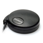
Use of Garmin GPS 18x USB

We installed the Garmin SPANNER software. This program allows you to route output from the GPS
18x USB to several virtual COM ports.

By default, the 18x USB outputs these NMEA telegrams at 4800 bits/s:

$GPRMC,135412,A,6023.0691,N,00519.8087,E,000.2,329.5,140610,001.6,W*6D
$GPGGA,135412,6023.0691,N,00519.8087,E,1,04,3.2,,M,43.7,M,,*6A
$GPGSA,A,2,17,15,26,28,,,,,,,,,3.3,3.2,*10
$GPGSV,3,1,10,17,34,099,34,15,50,175,33,26,57,173,28,28,29,057,26*70
$GPGSV,3,2,10,09,62,264,00,11,10,036,00,12,12,216,00,18,31,267,00*7D
$GPGSV,3,3,10,22,27,306,00,27,75,253,00*7B


One problem remains, though. Before we address it, let's recap the suggested GPS setup,
which is a bit complicated due to the many programs that are dependant on GPS input:


PC #1: Charting & navdata/echosounder logger, placed to the right of driver:
---------------------------------------------------------------------------
One GPS must be shared between two programs:
 a) Global Mapper
 b) Nav data % Echo Sounder logger
Neither of these program requires a particular setup of the different types of telegrams
transmitted.


PC #2: GUNCO and GEODE control, PC placed to the left of Workstation area
-------------------------------------------------------------------------
One GPS input must be shared between two programs:
 a) GUNCO distance triggering program
 b) GEODE recording of hydrophone/mini-streamer data
The GUNCO software does not require any particular setup of GPS.
The GEODE software, however, requires that only ONE NMEA telegram type is present, and it
must contain time/position data.


PC #3: Knudsen Chirp control, PC on the right-hand side of Workstation area
---------------------------------------------------------------------------
There's only one program on this laptop that needs GPS input.
I'm 99% sure that the Knudsen USB Sounder Suite control selected appropriate NMEA
telegrams from what was thrown at it.


The remaining 18x USB problem is that it seems impossible to configure the device to
output only a specified type of NMEA telegram. Download the configuration program:
SNSRXCFG software version 2.40 as of May 17, 2010 from:
https://buy.garmin.com/shop/store/downloadsDetails.jsp?id=4053&product=010-00321-31&cID=158&pID=27594
This only has consequences with regard to PC #2, so we must have a different solution
here.

The configuration program SNSRXCFG does not include the 18x USB as a valid choice (it
includes the 18x PC which has a normal serial port). But since the SPANNER program
transformed the USB device into a virtual COM port, we made an attempt - to no avail.

To conclude:
-----------

PC #1, charting + nav data/echo sounder logging:
       Use 18x USB with SPANNER software.

PC #2, GUNCO + GEODE:
       Use older Garmin serial GPS device ("mod. 35") that is already present
       in H/C, as input for the GEODE software. Connect to COM1 (built-in) on
       PC. It should already be configured only ONE type of NMEA telegram.
       Use port-sharing software "Franson GPS" to also route this COM port
       to other virtual ports, used as input for the GUNCO program.

PC #3, Knudsen USB Sounder Suite control:
       Use 18x USB with SPANNER software.
Garmin GPS 18x USB
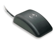
Garmin GPS35-HVS Garmin GPS35
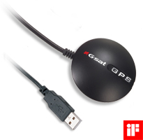
GlobalSat Mod. BU-353It is not possible to select the NMEA telegrams that GlobalSat Mod. BU-353 transmits. This makes it unusable as time- and position stamping device for the GEODE seismograph, as this unit uses whatever telegram present at the time of triggering; the GEODE log file may contain NMEA telegrams that does not hold time- and position data at all. This model will therefore be phased out before 2010 field season.  GlobalSat mod. BU-353
SOFTWAREProgram to select specific NMEA telegram and log data at user specified intervalsNew version available - combined Echo Sounder / GPS Track data logger. See Echo Sounder section.
GPS Config program (draft)Program to share one GPS among several applications |