|
Past operations & data Scientific equipment
Communications / Navigation / Tracking
Weather Ship contact info VHF Radio Call Sign: Maintenance  Last update: December 27, 2024, at 09:41 AM |
POSITION REPORTING
AIS - AUTOMATIC IDENTIFICATION SYSTEMRV "Sabvabaa" will mostly use Isfjorden as transit route to the ice covered areas further north. An AIS system would thus be of limited value - there are no other vessels around. Launching of the Norwegian AISSat-1 satellite in 2010 could, however, provide a new method of vessel tracking - must be evaluated:
IRIDIUM POSITION REPORTING SYSTEMSThere are several solutons. We can either acquire a unit that performs this task, or have one of our Iridium 9505A handsets, connected to computers via Data Kit (RS-232), transmit position information. NAL Research mod. 9601-DGS-LPReport from testing of this unit.  NAL Reserch Iridium Tracking Unit mod. 9601-DGS-LP
LeoTRAK RST470
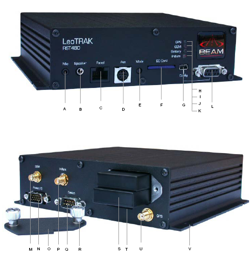 This unit could be programmed to transmit information at user defined intervals, and sleeps in between. It also has has a panic button feature. The RST470 uses Iridium Short Burst Data (SBD) service. The SBD telegrams must be retrieved from Iridum servers (as emails) at regular intervals, parsed and the information must then be used to generate web based map. Using 9505A Iridium PhoneFirst we have to be able to control the 9505A via the RS-232 based Data Kit. After some struggle with the special PDU format required, we managed to transmit SMS messages with the 9505A from a PC. Prototype software was written in Python. Reference documents in this regard:
In order to send SMS the 9505A hand set must first be enabled by storing the Iridium SMS Service Center Number in the SIM card, quoting from this web page:
Ref:
MAPPING LOCALLYUsing Global MapperGlobal Mapper has a GPS tracking input option, where vessel position can be kept in map center. IBCAO can be used for bathymetry. It is, however, difficult to set the desired bathymetry appearance, and also to plot vessel track line the way we want. So we will first attempt to use Generic Mapping Tools (GMT) for this task. VERSION 1: OBSOLETE - KEPT FOR REFERENCEScreenshot below shows the first version of a combined map machine and instrument integration application, using a standard browser as user interface. A JavaScript library called JQuery was employed in developing this interface. Unfortunately, this library had a severy memory leak problem, causing the application to run very slowly after a couple of hours. 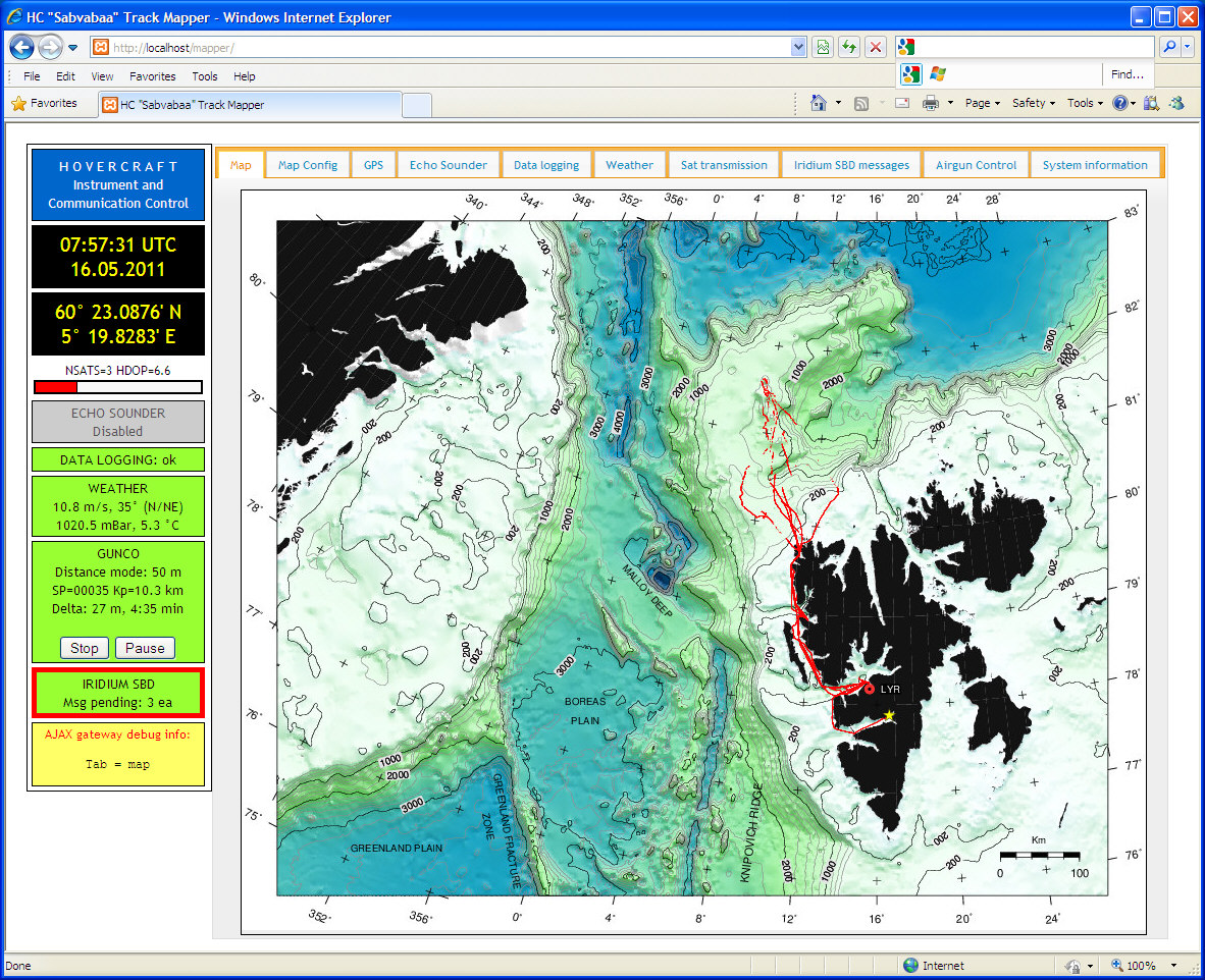 |