
|
Surveys and data Instruments
Support to other department sections Support Dr. Scient. thesis Contribution to "Scientific infrastructure"
Obsolete, kept for reference
Last update: April 30, 2025, at 08:49 AM |
MGG DATA SETS SHOWN IN GOOGLE EARTHThe location of most of our MGG (Marine Geology and Geophysics) data sets can be viewed in Google Earth by opening links to KML-files below. (KML is the data format used in Google Earth files). Google Earth should start automatically, provided is has been installed on your computer. If not, Google Earth can be downloaded from here. MCS (Multi Channel Streamer) and OBS dataMCS+OBS data (KML format), click and select "Open"; should open in Google Earth. It is not a complete listing of all department MCS+OBS data location. We are working on including all date, but cannot set a date for completion (this work is done in between). Note: Your Google Earth version should be recent (>= 6.0). Check version in Help -> About Google Earth meny. Screenshot of Google Earth with our dataset loaded is shown below. Line beneath cursor will be highlighted; click line and box with essential line information will appear. Follow link in this box to enter data portal. In the beginning, only navigation files in UKOOA P1/90 format will be available. Tip: To reduce information cluttering in Google Earth you can switch off display of "Borders and labels" and "Places" by clicking boxes in the "Layers" section to the left. Also display UTM zones by selecting this mode from the Tools -> Options -> 3D View meny.  Screenshot of Google Earth with GEO marine geophysical datasets shown. Click to enlarge. Right-click to download GEO-MGG-data.kml. Geology data setsThis KML file presents a sub-set of department geology data set locations. It's meant as a preview - links to datasets are not implemented. Geology data set locations (KML format) - should open in Google Earth. Click to open KML file: 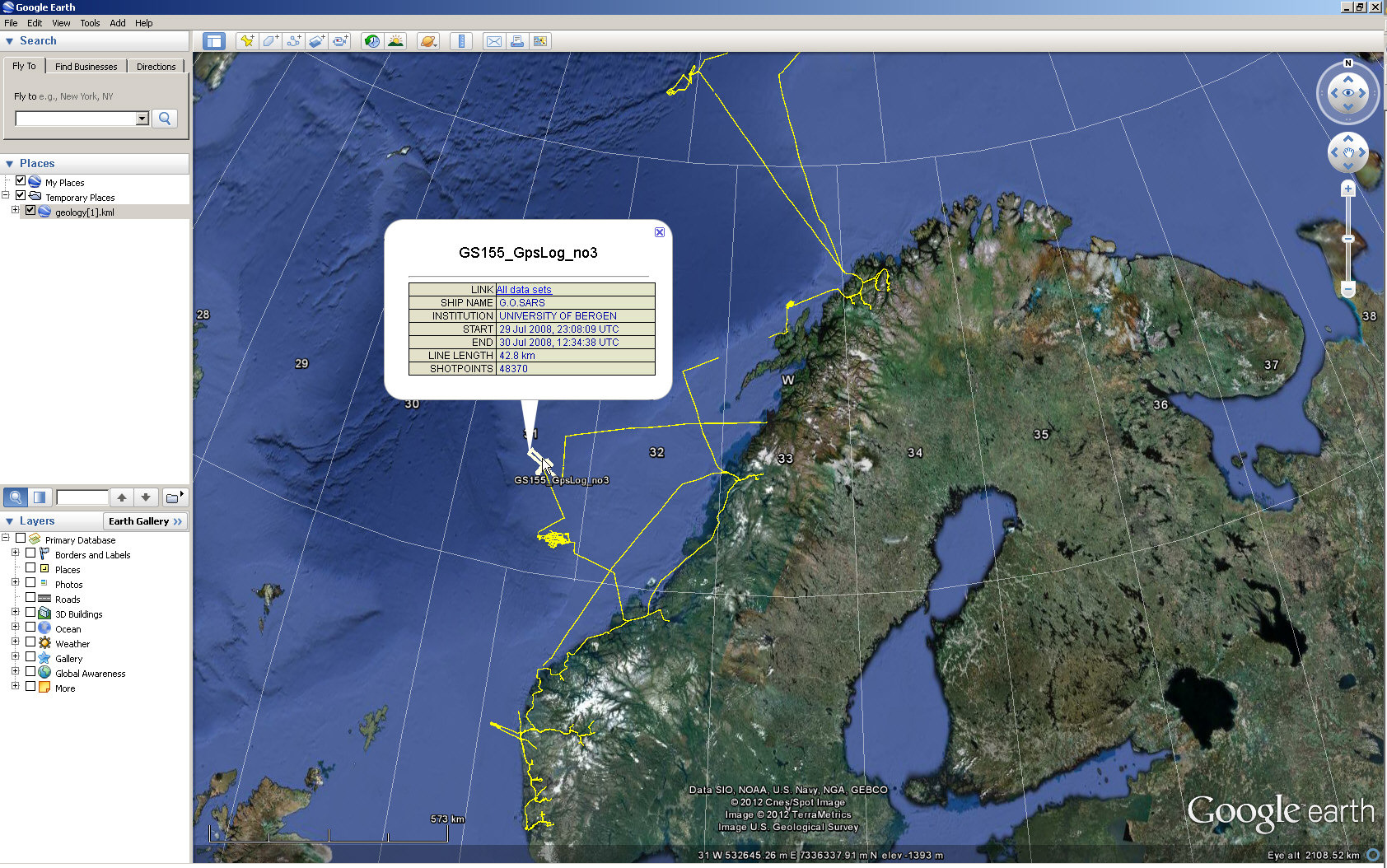 Preview of Department Geology data set locations - click to open KML file |