
|
Surveys and data Instruments
Support to other department sections Support Dr. Scient. thesis Contribution to "Scientific infrastructure"
Obsolete, kept for reference
Last update: April 30, 2025, at 08:49 AM |
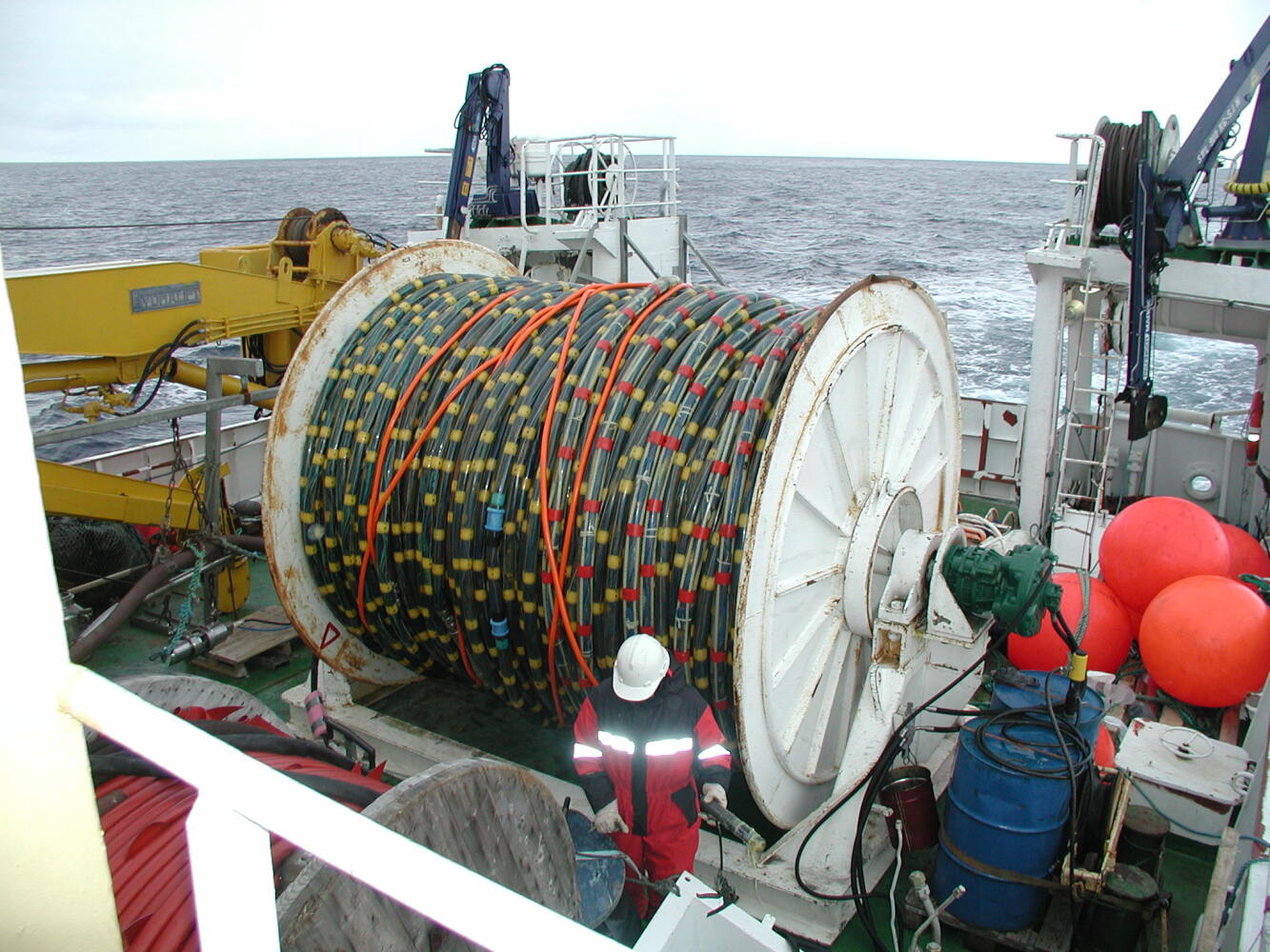 Click to see photo album. INTRODUCTIONThe survey was conducted from Sept. 11 to Sept. 24, 2001, onboard University of Bergen research vessel "Haakon Mosby". It was the first use of the digital 3 km 7 120 ch N-3 streamer. Link to original project web page (2006). DATA, LOG FILES, FORMAT DESCRIPTIONData and log filesTable 1: Data, log files Link to raw data Format description Survey Computer (EIVA) log filesShot event files
Shot (= Event) files; format example: Time in UTC pos WGS84 UTM zone 32 Event Time Easting Northing St.d. Gyro Dal Dol Kp Data ---------------------------------------------------------------------------------- 000001 20:19:27 0645265.93 08712571.46 10.00 226.8 -0398.41 000.56 -00.398 Filtered 0232.70 14624.99 14624.99 2001.00 54519.00 54519.00 000002 20:22:19 0644962.77 08712312.81 09.00 229.3 00000.08 002.25 000.000 Filtered 0238.00 14624.56 14624.56 2001.00 6875.00 6875.00 Start Recording: 000003 20:22:40 0644924.61 08712280.51 09.00 227.7 00050.08 002.66 000.050 Filtered 0239.10 14624.51 14624.51 2001.00 6876.00 6876.00 000004 20:23:01 0644887.17 08712247.47 09.00 227.7 00100.01 002.04 000.100 Filtered 0240.00 14624.45 14624.45 2001.00 54520.00 54520.00
 Field no. Example        Parameter                Notes
 ------------------------------------------------------------------------------------------
    1      000003         Shot (event) number
    2      20:22:40       Time
    3      0644924.61     UTM Easting              Refered to antenna position in mast.
    4      08712280.51    UTM Northing             Refered to antenna position in mast.
    5      09.00          Standard deviation
    6      227.7          Gyro compass reading
    7      00050.08       DAL                      Distance along line [m]
    8      002.66         DOL                      Distance off line [m]
    9      000.050        KP                       Kilometer post
   10      Filtered                                (check)
   11      0239.10        Depth                    From EK500 Echo Sounder
   12      52816.00       Magnetometer             (Length of mag tow fish cable - check!)
   13      12683.04       Gravitymeter             (Check - filtered, raw??)
Table 2. Shot (event) file format description. Logging of depth, gravity- and magnetometer data every 10 secondsFormat example: Tid i UTC pos WGS 84 UTM sone 32 Time;Filtered vessel position: East;North;Lat;Long;gravimeterdata;Magnetometerdata; 20:15:51 11.09.2001; 645632.1110;8712899.1428; 078°24.954311'; 015°30.566050'; 14625.9100; 54511.0000 20:16:00 11.09.2001; 645616.2427;8712886.0626; 078°24.948271'; 015°30.519964'; 14625.8600; 54513.0000 20:16:10 11.09.2001; 645598.7942;8712871.4546; 078°24.941510'; 015°30.469222'; 14625.8100; 54514.0000 NOTE: OCEAN DEPTH EXCEEDING RANGE OF SENSOR, RESULTING IN ERRENOUS READINGS, MIXED WITHIN GRAV-MAG DATA Field no. Example Parameter Notes
--------------------------------------------------------
1 20:15:51 Time
2 11.09.2001 Date
3 645632.1110 UTM Easting
4 8712899.1428 UTM Northing
5 078°24.954311' Latitude
6 015°30.566050' Longitude
7 14625.9100 Gravity
8 54511.0000 Magnetometer
Table 3. 10 second interval log file format description. LIST OF SEG-Y DATA DVDsLink to list PHOTO ALBUM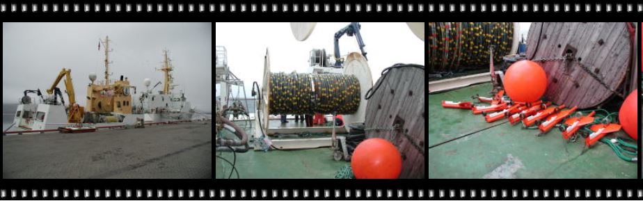 Link to photo album, credit IFG students and M. Vanneste, Department of Geology, University of Tromsø. DATA / TAPE HANDLINGLink to original web page. Recording parameters
From field tape in SEG-D to SEG-Y on Exabyte tapeConversion of raw data in DEG-D from 3480 tape to SEG-Y on Exabyte followed two different procedures. The first procedure was abandoned when release 35 of Seismic Unix permitted reading of SEG-D from files.
Tape informationDemux'ed data in SEG-Y format on Exabyte:
Tape archiving
|
||||||||||||||||||||||||||||||||||||||||||||||||||||||||||||||||||||||||||||||||||||||||||||||||||||||||||||||||||||||||||||||||||||||||||||||||||||||||||