|
Surveys and data Instruments
Support to other department sections Support Dr. Scient. thesis Contribution to "Scientific infrastructure"
Obsolete, kept for reference
Last update: April 30, 2025, at 08:49 AM |
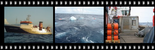 Click to see photo album. ABOUT THE RV "MARIA MERIAN" SURVEY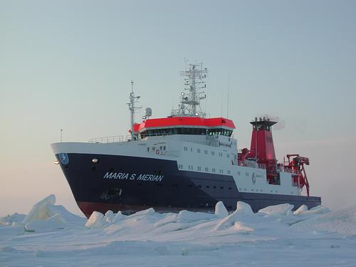 RV "Maria S. Merian", the most recent addition (as of 2007) to the German research vessel fleet. Survey is in Caribean waters, so image is perhaps a bit misleading ..! We contribute airguns, instrumentation and personnel to an OBS survey with the German research vessel "Maria S. Merian" in January 2007. The survey is conducted by GEOMAR, Kiel.
INSTRUMENTATIONOverview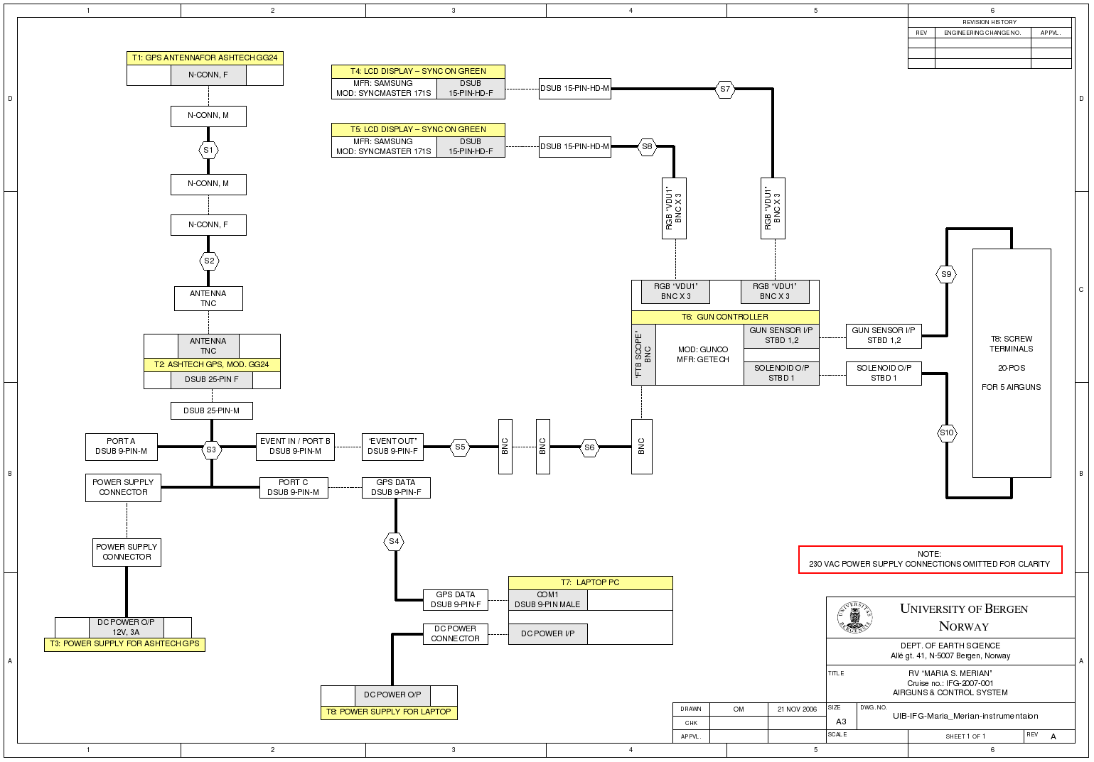 Cable diagram A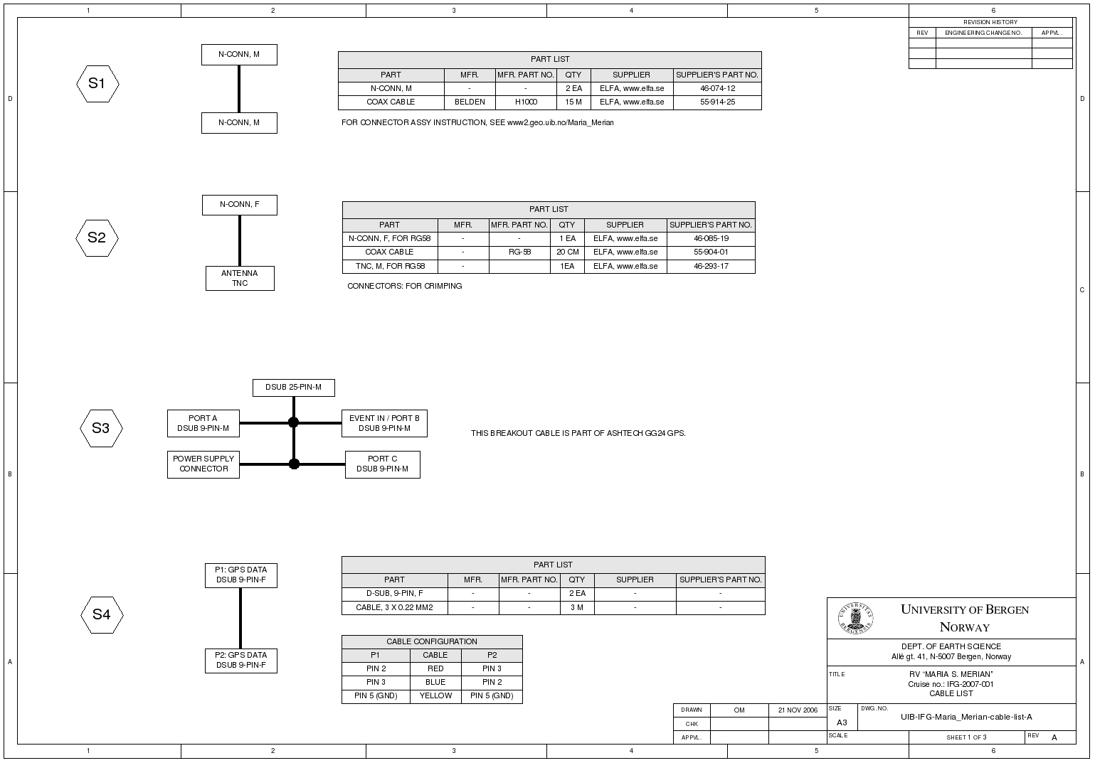 Cable diagram B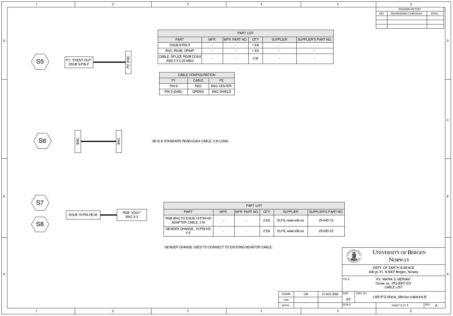 Cable diagram C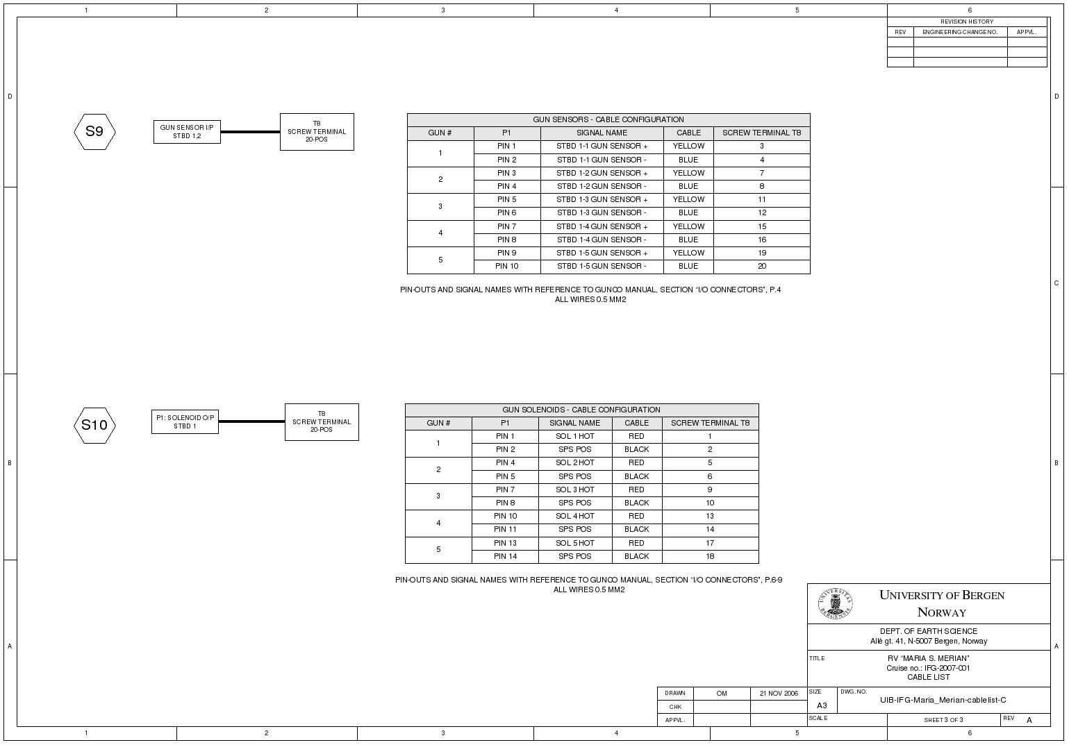
LOGGING OF TIME AND POSITION DATAAshtech GG24 GPS Ashtech GG24 GPS OBS surveys is dependent on time stamping of each airgun shot, to the nearest millisecond. The Ashtech GG24 GPS is furnished with an EVENT INPUT line to provide very accurate time tagging of external events. The Gun Controller "FTB Scope" signal, whose falling edge indicate Time Break (the moment that the guns should fire), is routed to the EVENT INPUT on the GPS. The time tag is transmitted as RS-232 data immediately after the event. The "GPGGA" NMEA sentence is also transmitted every second, in order to acquire latitude and longitude information on each shot event. The correct operation of the GPS is thus crucial to the success of the survey. A backup solution is highly disirable. We will look into the possibility of using an embedded microcontroller board, connected to an ordinary GPS that has RS-232 and PPS (Pulse Per Second) output, to provide a similar time stamping facility. Time, however, is not on our side ...
Time Tagging Unit (backup)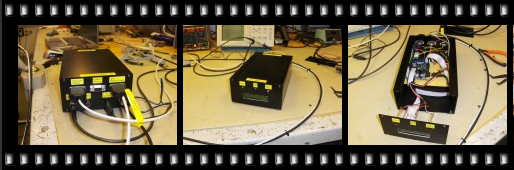 As backup to the Ashtech GG24 GPS we have a Time Tagging Unit (made by IFG). Here is a description / user manual for this unit.
UKOOA P1/1990 navdata file generationThe file that captures data from Ashtech GG24 GPS will have time stamp sentences (starting with $PASHR) intermixed with NMEA "GPGGA" sentences. Time stamp is given in GPS time, whereas GPGGA time is in UTC. As of Nov. 24, GPS time leads UTC time by 14 seconds (also called "leap seconds"). The file can look like this: $GPGGA,120918.00,6023.067642,N,00519.773534,E,1,7,4.3,30.905,M,45.78,M,,*54 $GPGGA,120919.00,6023.067660,N,00519.773567,E,1,7,4.3,30.882,M,45.78,M,,*5D $GPGGA,120920.00,6023.067680,N,00519.773666,E,1,7,4.3,30.979,M,45.78,M,,*5E $PASHR,TTT,2,12:09:33.2548793*00 $GPGGA,120921.00,6023.067701,N,00519.773704,E,1,7,4.3,31.010,M,45.78,M,,*55 $GPGGA,120922.00,6023.067734,N,00519.773913,E,1,7,4.3,31.220,M,45.78,M,,*59 $GPGGA,120923.00,6023.067732,N,00519.773878,E,1,7,4.3,31.164,M,45.78,M,,*51 In order to create an UKOOA P1/1990 nav data file, time stamp sentences must be extracted, and the correct number of leap seconds must be subtracted from the time stamp value. Latitude and longitude must be collected from the GPGGA sentence that is nearest in time. Date and month information comes from log book. Python is a suitable script language for this task. Will come back to this later. If the backup Time Tagging Unit is used the timestamps are given in UTC, so there is no need to make leap second correction.
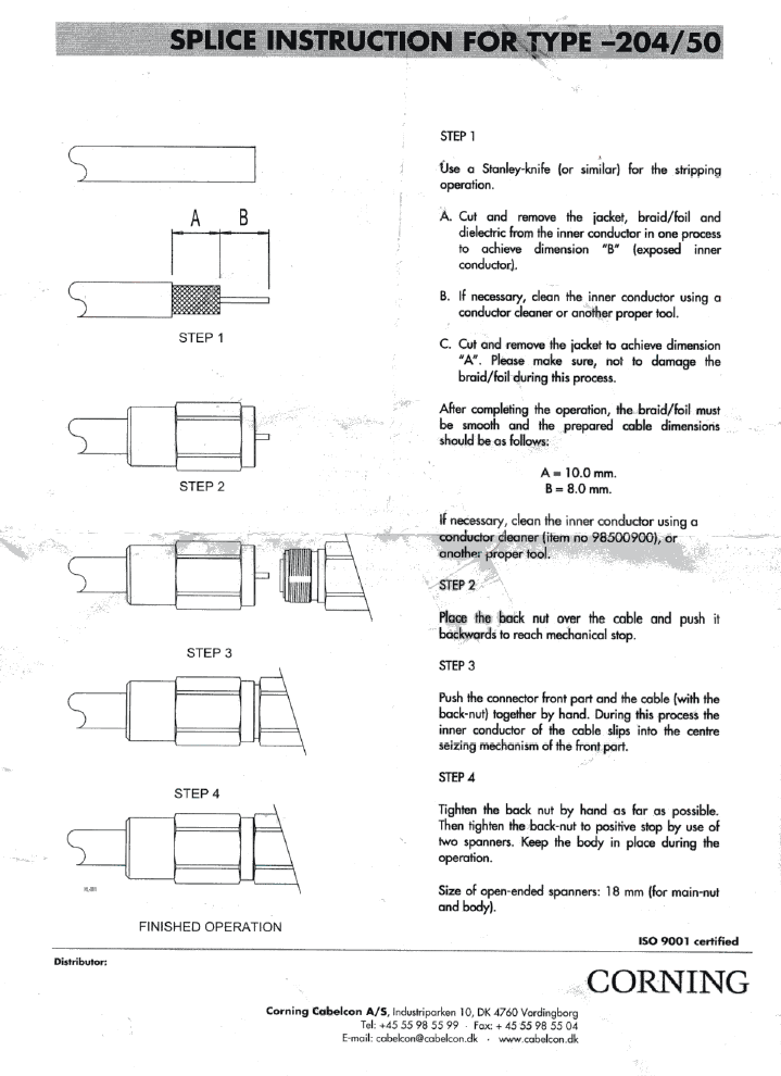
Misc. instrumentation informationN-connector for H1000 coax cableThe H1000 coax cable (designated "S1" in drawings above) is terminated with N-conn male (shown to the left in the image below). Termination instructions are provided on the right side. 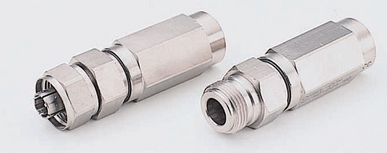 Doro PMR radio model "WT-86"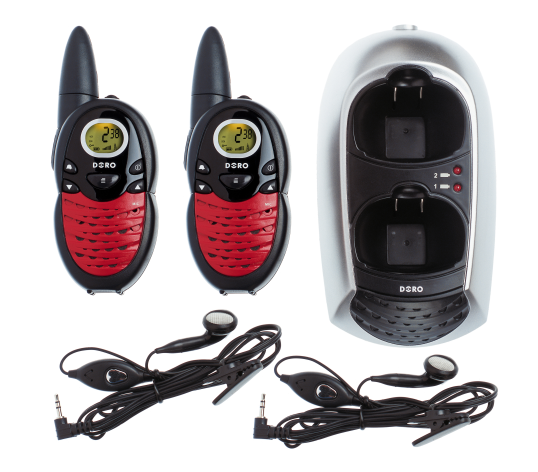 |
|||||||