
|
Surveys and data Instruments
Support to other department sections Support Dr. Scient. thesis Contribution to "Scientific infrastructure"
Obsolete, kept for reference
Last update: April 30, 2025, at 08:49 AM |
CAVE INSTRUMENTATION: MAPPING UNITAuthor: Jose Ojeda IntroductionTraditionally, caves have been mapped by the use of compass, tape and inclinometer. We want to replace these by:
The wanted specifications were:
We started doing internet search looking for equipment matching these requirements. There were equipment able to do compass direction, inclination and range measurement, but they were usually too bulky and too expensive for us. Price was from US$ 20 000 and upwards. These are often equipment used for construction work, and Leica Geosystem is a major provider. CaveMapper partsDue to low price criteria it was obvious that we had to use of-the-shelf components, and our job were to find a low power computer that could control and read data from the different sensors. The data should then be stored on non-volatile memory. After some investigation we ended up with the following components.
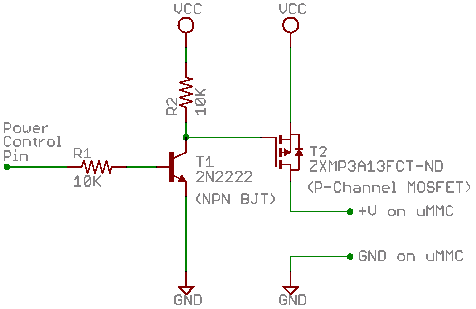
DevelopmentStarted with building a board for the Basic Atom Pro 28-M microcontroller. It has an integrated circuit for TTL to RS-232 level conversion and reverse. Power management, shuting down if battery goes under a certain voltage.  Figure 2. The BasicAtom Pro hidden under all the cables to the LCD display, mmc card unit, and sensors. Dimitix is the grey unit on the left side, and the Revolution is the black unit to the right of the power supply. The version 7.2 of the Atom Pro development environment was used. The newer beta version 8.0 had errors and did not compile the code. Documentation
ReferenceCompass, inclinometer
Laser distance meter with data output
Small computer for control and data storage. Using the BasicAtomPro microcontroller for controlling all the sensors and storing the data. Waterproof case |